In today’s digital age, Archaeology AI has brought a new revolution in the field of archaeology. Earlier, where it used to take many years to find a lost civilization, now with Archaeology AI technology, the map of the entire area, possible excavation sites and even secret tunnels can be found in a few months.
Today, big institutions of the world like MIT, University of Cambridge, and many Indian institutions are also doing research on Archaeology AI so that our unknown civilizations can be seen again.

AI in Archaeology: How the world is changing
AI in Archaeology means the use of Artificial Intelligence in Archaeology. It uses machine learning, computer vision, satellite imagery and big data analysis.
With the help of Archaeology AI now: ✅ Remote areas are scanned from satellites.
✅ Underground structures are identified with accuracy.
✅ 3D models of old ruins are made.
✅ Time and cost are saved during excavation in ruins.
Earlier, when archaeologists had to excavate at a new place, they first had to walk on foot and see the entire area – where is the mound, where is the ground uneven – then estimate whether something old could be hidden here or not.
This used to take months and many times even after digging, nothing special was found.
Now AI and satellite imagery have made this work very easy.
Scientists take high-resolution satellite images and AI analyzes those images – like finding a hidden pattern, which is not normally visible to the human eye.
AI combines old maps, weather data and the composition of the soil to tell if there are any buried structures under the ground.
The advantage of this is that even in remote forests, deserts or mountains, we can decide in advance where to dig without physically going there.
How are 3D models of old monuments made?

Imagine there is an old fort or temple which is now broken. If we want people to see it as it was once, then 3D modeling is used.
In this, archaeologists use drones or laser scanners which scan old walls and structures from thousands of angles.
Then AI and computer vision join all that data and prepare a realistic 3D model.
People can virtually walk around and see such models using a computer or VR headset — as if you are standing at the real place.
How does AI reduce the cost of excavation?
Excavation is a very expensive process — workers, experts, machines and their food and drink all cost money. If you dig in the wrong place, money is wasted!
AI helps here too:
First, AI suggests the right location so that you do not have to dig anywhere unnecessarily.
During digging too, AI analyses the data and tells how deep it would be right to go.
When soil or stones samples are taken out, AI immediately analyses and tells whether there is any historical thing in it or not.
Sometimes AI robots or automated machines also do the excavation, which reduces the cost of human labour.
Machine Learning Archaeology: Identification of lost civilizations

Now let’s talk about Machine Learning Archaeology!
As the name itself makes clear – in this, Machine Learning algorithms were designed to analyze old maps, soil samples, inscriptions, pottery pieces, patterns of old walls. Its only job is to analyze all these.
Earlier, archaeologists used to do all these tasks manually, it was a bit difficult. This work also took a lot of their time. – One had to compare each map, match the size of bricks, which civilization was in which area when, and estimate all this by combining all this.
Now in Machine Learning Archaeology, algorithms do this work faster and with more accuracy. This is what AI Archaeology does very easily, but it is not easy to understand its learning. Let me explain this with some examples.
How are patterns and similarities found?

Suppose bricks are found during excavation at some place – Machine Learning models will immediately scan those bricks, if those bricks have already been found in its system, then it will tell and will match both of them immediately, so that it will know that these bricks were used in a particular civilization or were found. Machine Learning models will also match the size, material, and design pattern of those bricks with other old records and tell that these bricks are so old.
Then it is known that these bricks belong to a particular time period and culture.
Similarly, AI also scans inscriptions or ancient writings and compares similar words or script patterns of that language.
This helps archaeologists to know which civilization was where and what were their connections.
Some interesting examples of Machine Learning Archaeology
✅ Egypt: Lost Cities
Everyone knows about the pyramids of Egypt — but humans had never even guessed about the ancient hidden cities around those pyramids.
Machine Learning Archaeology models identified lost settlements by combining satellite imagery and ground data — then excavation was done and proof was also found! Which proves the ability of machine learning archaeology, how useful is it.
India – Indus Valley Civilisation:
Machine Learning Archaeology is being used in Harappan sites (Indus Valley Civilization) in India too.
By studying old maps and soil samples through ML algorithms, signs of some new buried settlements have been found — due to which we are able to understand ancient trade routes and migration patterns better. Due to which many curtains of the secrets of the Indus Valley Civilization have been revealed. In fact, I had already said that the Indus Valley Civilization is the civilization of that era, when there was a catastrophe in the world and the whole world was flooded with water.
AI to Find Lost Cities: Anonymous cities will now be revealed
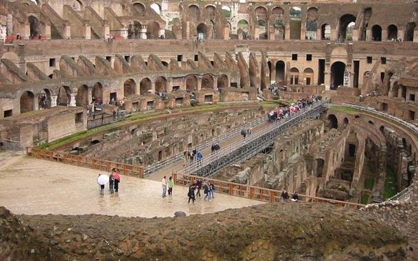
Do you know? There are thousands of cities in the world that got buried under soil, forests or deserts centuries ago for some reason – the course of rivers changed, wars took place or people left those places for any reason.
Earlier, it used to take decades for archaeologists to find these lost cities – that too without any guarantee whether they would be found or not. But now AI to Find Lost Cities has brought a revolution in the world of archaeology.
🛰️ How does AI to Find Lost Cities work?
Today archaeologists don’t just dig on the ground – they use AI tools that combine different technologies together: such as
✅ Satellite Imagery:
Ultra high-resolution images are taken from space, which detect even the smallest changes on the surface of the ground. Sometimes crop patterns in the fields also reveal hidden structures.
✅ LIDAR (Light Detection and Ranging):
LIDAR is an advanced laser technology that can even ‘see’ the dense canopy of trees in the forests. That is, if a temple or an old city is buried under a dense forest, then LIDAR makes its 3D image.
✅ Drone Mapping:
Drones fly low-level and scan inaccessible or dangerous areas.
AI analyzes these drone images and brings hidden roads, buried walls, old ponds – everything virtually to the surface!
All these techniques together make AI to Find Lost Cities a super tool. And from here its importance increases even more.
Some amazing examples of AI to Find Lost Cities
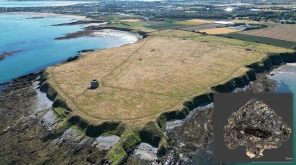
Now it is not that AI archaeology has no role in AI to Find Lost Cities. Some such cities have been discovered due to this technology, which were almost impossible for archaeologists to dig. Or who knows how many thousands of years it would have taken, till I, you, our children, their children, may or may not have been alive, don’t know. That work came today which this technology did very easily.
✅ Cambodia – Angkor Wat: Lost Cities
Angkor Wat is famous all over the world, but there was a whole hidden city in the dense jungle around it – big roads, reservoirs and ruins of temples.
Scientists ‘removed’ the forest canopy using LIDAR and AI algorithms and made a complete map of that ancient city. Now tourists can see not only the temple but the entire old city virtually.
✅ Sahara Desert: Lost Cities
Sahara Desert looks like just sand, but AI to Find Lost Cities technology has revealed that there was once a lush green river system and villages beneath it.
With satellite and soil data, AI is tracing buried settlements and ancient river systems — giving new insights about the Sahara’s ancient climate and civilizations.
How did archaeologists benefit from AI to Find Lost Cities?
Earlier, without technology, archaeologists had to survey entire deserts or jungles for months and years, but now AI models do the same work in a few hours or weeks.
This has made it easier to pinpoint excavation sites — meaning there is no need to dig unnecessarily, which saves both money and effort.
The trade routes, ancient drainage systems and temples of ancient civilizations help solve a big historical puzzle.
What is the future of AI to Find Lost Cities?

Now archaeologists are using AI to find lost cities on every continent of the world – South America’s rainforests, India’s buried forts and the Middle East’s lost caravan cities are all coming back to life.
That means the time is gone when a lost city would remain buried in the soil forever. Today, AI, satellite, LIDAR and drone mapping are bringing our lost history back to the world – and that too without spending millions unnecessarily!
SAR Imagery Archaeology: The story inside the earth
SAR Imagery Archaeology i.e. Synthetic Aperture Radar (SAR) technology is also a big part of Archaeology AI. SAR Radar can scan walls, tunnels or stepwells hidden several meters below the surface of the earth.
In Archaeology AI, SAR Imagery data is combined with Machine Learning models to detect hidden sites. In Rajasthan, India, new excavation projects are being planned with SAR Imagery Archaeology.
Future of Archaeology AI in India

If India is called the living museum of the world, it will not be wrong.
Here in every state, every hill, every river bank, every desert and forest, some ancient story is buried.
But the problem is that proper care and research of these heritage sites is often not possible – remote areas, tough terrain and lack of resources are the major reasons for this.
This is where “Bharat mein Archaeology AI ka bhavishya” becomes very exciting!
New paths of excavation with AI and Advanced Tech
Now archaeologists are not just people who dig with their hands.
Now they work with AI experts, drone pilots and satellite data analysts.
The scope of Archaeology AI is very big in India too:
✅ Aravalli Hills: Lost Cities
Many ancient forts and temples are hidden inside jungles and hills in the Aravalli range (which extends from Rajasthan to Haryana and Delhi). We have written about many of them in our article. Especially in Mewat History.
AI powered satellite imagery and LIDAR mapping are helping archaeologists to know where hidden caves, water systems or lost settlements can be.
✅ Gujarat and Sindhu Ghati (Indus Valley) sites: Lost Cities
Indus Valley Civilization was one of the most advanced ancient cultures in the world — but even today many of its unexplored sites are buried under the soil in the fields of Gujarat and Haryana.
This is where the future of Archaeology AI in India shines — because Machine Learning models are giving signals of new buried settlements to archaeologists by analysing old excavation data, satellite images and soil moisture patterns.
This keeps excavation targeted — meaning no extra money is wasted, and no need to dig the ground unnecessarily!
✅ Desert Regions like Rajasthan and Thar Desert: Lost Cities
AI to Find Lost Cities technology is helping to trace ancient trade routes and caravan towns here.
Old maps, satellite thermal imaging and drone photogrammetry are revealing where villages and oasis once existed.
Why is the future of Archaeology AI in India promising?

Low Cost + High Accuracy:
AI tools are costly but they save costs in the long term compared to traditional excavation.
You can imagine — earlier archaeologists used to survey for years and many times nothing was found on the site! And you also know that the Indian government can do everything but it does not have any budget to find ancient history.
Due to which now virtual excavation is done before Archaeology AI – which digitally reveals the structures under the soil.
Heritage Protection:
With AI, we can digitally preserve ancient monuments and sites.
Like making 3D models, making VR tours – this will not only allow tourists but also researchers to study without harming the site.
Involvement of Local Communities:
The future of Archaeology AI in India will be sustainable only when local communities are also trained – to operate drones, collect data, monitor the site.
This will also generate employment and strengthen the protection of our heritage.
Future vision: Digital Bharat, Ancient Bharat
Imagine tomorrow – you are watching a 3D walkthrough of an ancient buried city on your phone, watching drone live footage or participating in a virtual excavation – everything will be possible only due to Archaeology AI.
In India, IITs and many universities are already running pilot projects in this field – many states have started satellite-based heritage mapping.
That is, in the coming 5–10 years, the future of Archaeology AI in India will bring a new digital revolution for archaeologists, historians and heritage lovers.
Archaeology AI: Future Ready Heritage

Archaeology AI is not just a technology, but it is a modern weapon to protect our cultural heritage and ancient civilizations for future generations.
👉 Through this, the map of buried civilizations is emerging again.
👉 The combined efforts of Machine Learning, SAR Imagery, Drone Mapping and AI have made Archaeology future ready.
If you are also interested in ancient civilization, historical mysteries and Archaeology AI – then this is the perfect time to learn more about it, read and spread it to others. Let us join hands to strengthen this movement to digitally protect India’s heritage!
If you liked this information – then definitely share it on your social media handles, and use #ArchaeologyAI.
The more you share it, the more people will understand the importance of Archaeology AI in India.
This awareness will also promote new excavations, heritage conservation and new employment opportunities for people in the future.
So definitely share – because you are also a part of this movement! 🙌🇮🇳✨
